Chart of the week: So low
By Karen Unland
As you have no doubt noticed, it's darn cold.
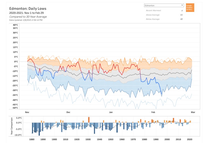
Chris Nelson of Edmonton Weather Nerdery generated a graphic representation of how far our lows have fallen, hitting a chilly -33.9 C on Feb. 7.
Up until the end of the third week of January, our winter had been abnormally warm, relatively speaking, which may be contributing to the shock of the current cold snap. As Nelson noted on Twitter, Saturday was the first time Edmonton has seen -25 C this winter, and Sunday was our first -30 C. Check out this set of charts for more number-crunching about the history of -30 C in Edmonton.
Due to the "heat island" effect, Edmonton was still about 10 degrees warmer than surrounding areas, tweeted Environment Canada's Alberta office. The entire province is under an extreme cold warning, as is much of Canada.
The City of Edmonton's extreme weather response was activated on Feb. 4, opening shelter spaces and running free overnight buses to convey vulnerable Edmontonians to them. The response is expected to remain in effect until at least Saturday.
If you're concerned about someone who is outside in the cold, call 211 and press 3 to send help.
For many more charts on Edmonton's weather, visit Edmonton Weather Nerdery.
Share