Dismantling Edmonton's half-built freeway begins on Rossdale Road
Work that will begin to undo Edmonton's incomplete 1970s downtown freeway project is already seeing asphalt removed in one of the city's oldest neighbourhoods.
As part of the routine rehabilitation of Rossdale Road, the city has opted to redirect southeast-bound traffic to other routes, closing the vehicle lanes permanently. Drivers that would have used the now-closed sections of Rossdale Road to reach 97 Avenue will now use 99 Avenue, westbound, and turn southbound on Bellamy Hill Road.
The city said the redesign helps simplify an area it calls dangerous and confusing.
"The changes we proposed on the Rossdale Road rehabilitation are necessary to eliminate some of the confusion where the triangle portion of 103 Street, Bellamy Hill, Rossdale Road, and 97 Avenue connect," said Satya Gadidasu, the City of Edmonton project manager in charge of the redesign.
The former vehicle lanes have been stripped of asphalt and returned to dirt, and trees will eventually be planted. An existing sidewalk will be widened to become a multi-use path for cyclists and pedestrians.
The neighbourhood's city councillor is enthusiastic about the changes.
"The road network redesign really helps us rededicate some existing lands for green space, so I think that's a really positive outcome," said Ward O-day'min Coun. Anne Stevenson.
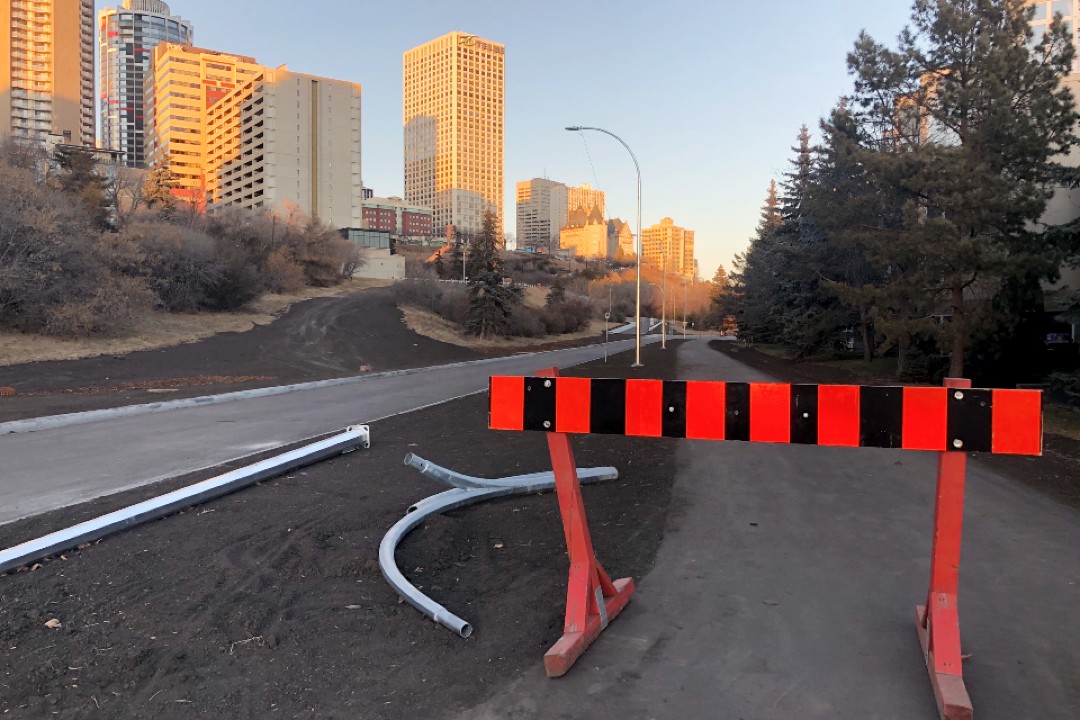
The city has stripped Rossdale Road's southwest-bound vehicle lanes of asphalt and will plant trees in the newly exposed dirt. (Stephanie Swensrude)
Why does this area have so many routes that lead drivers to the same destination?
"The existing network in Rossdale, as well as close to the Low Level Bridge network, is built based on the 1970s Metropolitan Edmonton Transportation Study, where it was assumed that we would have freeways to go everywhere in and out of downtown," Gadidasu said. "However, as the city has grown, over a period of time the priorities have shifted and more priority is given for people travelling rather than vehicles travelling."
Many decades ago, the city commissioned the Metropolitan Edmonton Transportation Study (METS), which imagined a freeway loop encircling the downtown core, similar to what today exists in many American cities. Construction of the freeway loop started with the James MacDonald Bridge and the roads on either side. Looking from a bird's eye view, one can today see that, unlike downtown, where streets are a slow-speed grid, this area is instead an Anthony Henday-esque space, with high-speed slip lanes and clover-leaf interchanges.
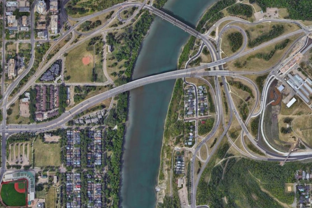
Parts of the transportation network in Rossdale were built when the city envisioned a freeway loop encircling the downtown core. (Google Maps)
Edmonton eventually abandoned the freeway plan after sustained outrage from area residents, especially Margaret Chappelle and her neighbours near the MacKinnon Ravine. That history is explored in Episode 58 of Let's Find Out.
The city said it wants to simplify the parallel routes that essentially get drivers to and from the same places. Planners are also proposing to eventually close the southwest-bound portion of Bellamy Hill Road, west of 103 Street and north of 97 Avenue.
The changes are just the first steps in the Rossdale Transportation Network Plan. The concept plan, completed in 2022, has no timeline for its design or construction. The proposed changes that most vehicle commuters will notice, if built, will be along 105 Street, 97 Avenue, and the southwestern half of Rossdale Road.
In the concept plan, 105 Street will be narrowed from four lanes to three along most of the road between the Walterdale Bridge and 97 Avenue. The plan includes adding a bike lane and widening sidewalks along the street. The plan does not include narrowing 97 Avenue — except to remove dedicated right turn lanes — but does include a bike lane on the south side of the road and adding traffic lights at every intersection.
Other plans suggest that, in the longer term, "a redesign of 97 Avenue, the widest road in central Edmonton, should be contemplated to reduce its barrier effect on walking and cycling between Rossdale and downtown."
The current road is about 30 metres wide. For context, the Whitemud Drive freeway ranges in width from 25 metres to about 45 metres.
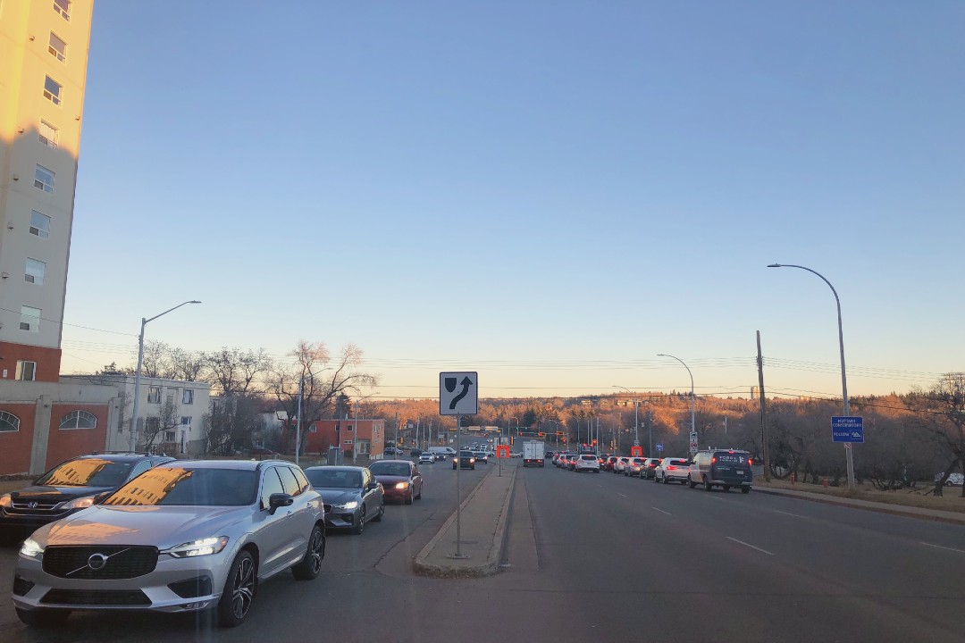
Edmonton's 97 Avenue is about 30 metres wide in places, making it a barrier to those walking and cycling between Rossdale and downtown, according to the city. (Stephanie Swensrude)
While Rossdale Road is one current option for commuting into downtown, the concept plan sees the road turned into a two-way, "park-like" street. Sidewalks could be built on the northwest side of the road, and a bike route on the southeast side.
Rossdale is also a neighbourhood people walk and bike through when accessing the river valley from downtown or from the east and west, though the city notes the road network makes that option less attractive. The plan introduces new pedestrian paths and routes, including the new one added to Rossdale Road. "The (shared-use path) will provide (an) enhanced connection for cyclists and pedestrians to have better access to downtown and to the river valley," Gadidasu said.
This transportation network redesign goes hand-in-hand with the River Crossing Business Plan, which envisions how Rossdale might transform from a sparse, car-centric area to one with more residential, retail, and recreational uses.
It's about filling in gaps, Stevenson said.
"Right now you have quite high density on the west, and you have a really well-established residential neighborhood to the east," she said. "In between, it's a lot of undeveloped and underdeveloped property intersected by tons of these overbuilt streets, so it really breaks that connectivity."
The business plan envisions what is now open space could be filled by commercial and residential buildings, with up to 4,000 people living in the neighbourhood. The city imagines the street outside of RE/MAX Field — 96 Avenue and 104 Street — turned into curb-less, pedestrian-focused streets with shops and restaurants.
Residents opposed to the plan said they are concerned about a lack of parking — the open space that is used as parking for baseball games would be developed — and that the redesign would impede traffic flow.
The city's 2023-2026 budget funded planning and design of the business plan, but there's no timeline for construction.
"This project will see the redevelopment of a community in our core into a destination, rather than a location that people drive past and wish to visit," the city said, in planning documents.
Beyond making Rossdale more walkable, there are several other projects in motion to make the neighbourhood more of a destination, such as an interpretive park, a rehabilitation of the Ortona Armoury building, and the Touch the Water Promenade.
Share